HOW-TO: GEAR, TUTORIALS & TIPS

RESTRICTION GRADES:
A MEASUREMENT-BASED SYSTEM
Part 1 of 2: A new way to label restrictions using measurement-based restriction grades.

RESTRICTION GRADES:
FUTURE REVISIONS?
Part 2 of 2: A look at potential revisions to the grading system.

BLOG:
LINES OR NO LINES?
3 reasons why guidelines should not be on cave maps, and why I chose to ignore them.

DIVE GEAR:
SURVEY TEMPLATES
Gear: Download and print a template for underwater cave survey.
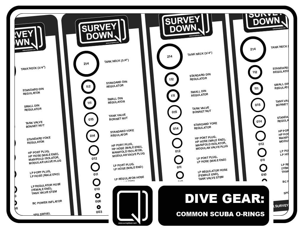
DIVE GEAR:
SCUBA O-RINGS
Gear: Download and print a true-to-size table of the 10 most common scuba O-rings.

USING WALLS:
EXPORTING AN SVG
Part 7 of 8: Learn how to export your data as an SVG for drafting in Adobe Illustrator.

GEAR REVIEW:
WATERPROOF PAPERS
Review: Comparing waterproof papers for the purpose of underwater cave cartography.

READING MAPS:
BCRA SURVEY GRADES
Part 5 of 8: A quick look at the BCRA Survey Grade system.

USING WALLS:
ADDING COLOR
Part 6 of 8: Learn how to change the style and color of your survey using the Segments Tab.

USING WALLS:
LRUD DIMENSIONS
Part 5 of 8: Learn the basic steps to entering LRUD dimensions to underwater dive survey.

READING MAPS:
CROSS-SECTIONS
Part 4 of 8: A quick look at how to make better use of the cross-sections on an underwater cave map.

READING MAPS:
UIS CAVE SYMBOLS
Part 3 of 8: A summary of the UIS Cave Symbols for cave divers.
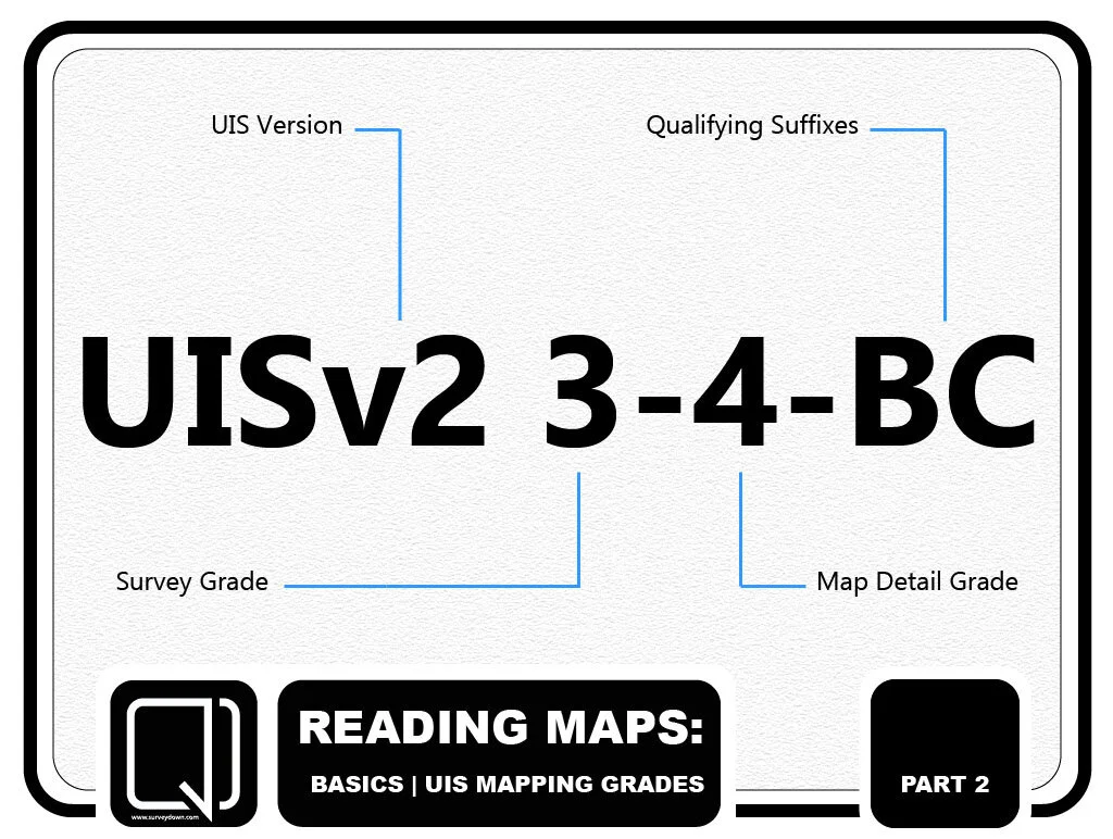
READING MAPS:
UIS MAPPING GRADES
Part 2 of 8: A quick look at the UIS Mapping Grade system.
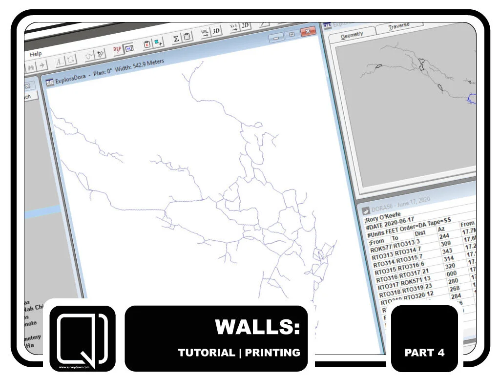
USING WALLS:
PRINTING A SURVEY
Part 4 of 8: Learn how to print an underwater cave survey using Walls Project Editor.

USING WALLS:
GOOGLE EARTH PRO
Part 3 of 8: Learn how to export your dive survey to Google Earth using shapefiles.

USING WALLS:
CONNECTING CIRCUITS
Part 2 of 8: Connect underwater circuits using the cave survey application, Walls Project Editor.

READING MAPS:
WHICH WAY’S NORTH?
Part 1 of 8: Learn the basic differences between True North, Magnetic North, and Grid North.

GEAR TUTORIAL: MAKING DIVE SLATES
DIY Series: Make a custom dive slate using PVC tubes from the hardware store.

USING WALLS: ENTERING DIVE SURVEY
Part 1 of 8: Create a project and enter underwater cave survey using the Walls Project Editor.

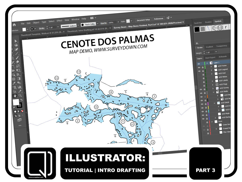
INTRO DRAFTING: TRACING WALLS
Part 1 of 3: Trace the walls over a scanned section of the Dos Palmas Cartography Project.

INTRO DRAFTING:
ADDING COLOR
Part 2 of 3: Add color to an underwater cave map using Adobe Illustrator.
INTRO DRAFTING:
CROSS-SECTIONS
Part 3 of 3: Trace the cross-sections over a scanned section of the Dos Palmas map.

MAPPING CAVES: INTRODUCTION
Part 1 of 5: Learn the basics of how cave divers explore, survey and map flooded cave systems.
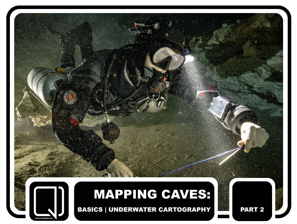
MAPPING CAVES: SURVEY & EXPLORATION
Part 2 of 5: A basic overview of cave diving survey and exploration.

MAPPING CAVES: SKETCHING UNDERWATER
Part 3 of 5: A quick look at how cave divers draw underwater maps.

MAPPING CAVES: DIGITIZING THE MAP
Part 4 of 5: Learn the basics behind making digital copies of hand-drawn maps.

MAPPING CAVES: ALTERNATIVE METHODS
Part 5 of 5: A short look at photogrammetry and further reading on cave cartography.